Science
Sorting Out the Background Ozone
Take a deep breath of air, and ask yourself: Where did that air come from? Perhaps it came from your neighborhood, your town, or your county—or perhaps it came from somewhere far, far away.
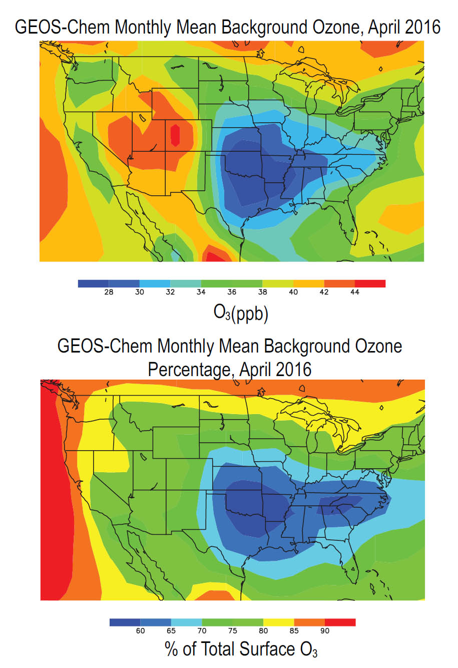
That’s the question scientists are trying to answer, specifically for the background ozone (O3) in our air over the United States. Any O3 that does not originate from U.S. man-made emissions—such as pollutants entering our atmosphere via long-range transport, carried across borders and oceans on air currents—is considered background O3. And when it comes to measuring our man-made emissions, background O3 can skew our understanding significantly.
It’s difficult to discern the origins of measured O3, and our ability to determine how much forms via U.S. man-made emissions, and how much forms via other means, is limited. This hampers regional efforts to use local emission reductions to meet U.S. National Ambient Air Quality Standards. After all, if we don’t know how much we’re contributing to the overall O3 in the air, how can we set targets for further reducing our man-made emissions?
Fortunately, scientists have come up with a way to estimate background O3 and give us a clearer picture. They took a page out of the weather forecaster’s handbook: In weather forecasting, current observations of meteorological conditions are processed with sophisticated numerical models to predict what the weather will look like tomorrow or next week. In much the same way, scientists are using similar tools called Chemical Transport Models (CTMs) to process new data sets collected by satellite instruments, such as the Tropospheric Emission Spectrometer (TES), and quantify the background O3 in our atmosphere.
To quantify background O3, scientists calculate the distribution of ozone in the absence of local emissions. Ozone forms from a chemical recipe of nitrogen dioxide (NO2), carbon monoxide (CO), and other ingredients in the presence of sunlight, so scientists focus instead on emissions generated by global assimilation of these ingredients to calculate the background O3 we’re breathing. Assimilating satellite data sets with CTMs in this way provides a more accurate picture of the background O3 in our atmosphere—and by removing it from the overall picture, we can better gauge how much U.S. manmade emissions contribute to the total O3. With this improved understanding of our own man-made emissions, we can set realistic goals for reducing them over time—and, knowing that, maybe we can breathe a little easier too.
Citation: Neu, J. L., Miyazaki, K., Osterman, G., & Bowman, K. W. (2020). Using satellite data to inform estimates of background ozone. EM: The Magazine for Environmental Managers.
Mission Highlights
Swipe to view more highlights
Loading mission highlights...